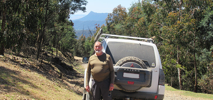
Gathering Coordinators: Colin and Heather
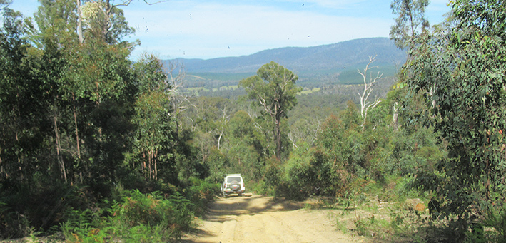
Our 2019 Annual Gathering was based at Taggerty Big 4 Caravan Park from Sunday Sunday 24th to Friday 29th November, with nearly all members of the Club attending for all or part of the week. Most chose to camp in the well-maintained and grassy unpowered area beside the Acheron River.
The weather for the week was fine and pleasant except for Monday evening and Tuesday morning when some light rain, and even hail for one trip, added variety.
Each day from Monday to Thursday, two trips were offered for participants to choose between. At around 5:00 pm the troops gathered around the campfire for happy hour and the events of the day were recounted and the next day's trips announced. After dinner, members re-gathered at the campfire for yet more chin-wagging.
Tuesday evening had us all gathered in the camp kitchen for a communal barbecue, while on Thursday evening we enjoyed a pub meal at the Rubicon Hotel in Thornton, with most members making use of the courtesy bus to travel to and from the hotel.
It is incumbent on me, on behalf of all members of the Club, the express our appreciation to Colin and Heather for the tremendous effort they put into making this another successful and memorable Gathering, and to thank the individual trip leaders for the variety of trips offered.
The reports from each trip follow...
Monday 25th November
Looking for the Wolfram Mine - Leaders: Keith and Monica
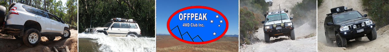
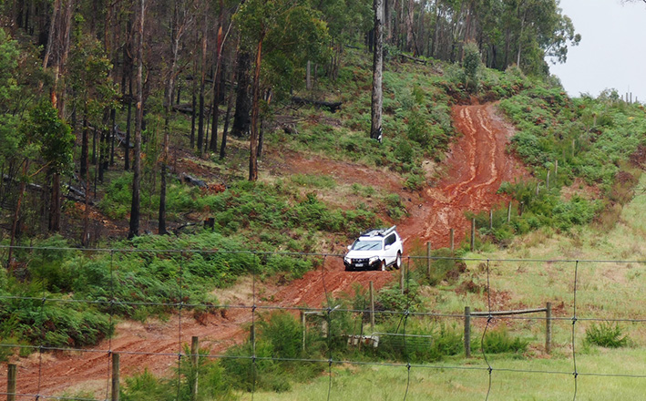
Seven vehicles left Taggerty CP and headed south and turned off onto Dom Dom Road. A sign said “No Through Road”. We found out why when we reached a large tree across the track. Gary said 15 minutes with the chainsaw would clear it. Yes, it was cleared in 20 minutes using 3 chainsaws. We continued our planned route to discover machinery working on Granton Bridge and the road closed.
The main purpose of this trip was to visit Lowering Gear Track, where timber workers used to lower the logs to the Feiglan’s Mill site, and also find the Wolfram Mine which we visited in 1990. However, nature has taken over and completely obliterated these tracks.
Lunch was at Anderson Mill Camp and then we worked our way along Neds Track, Granton Road hoping to find Pitt Track, but with confusing maps and no signposts we ended up on North Creek Road and met the Maroondah Highway to return to camp.
Text and pic: Monica and Keith
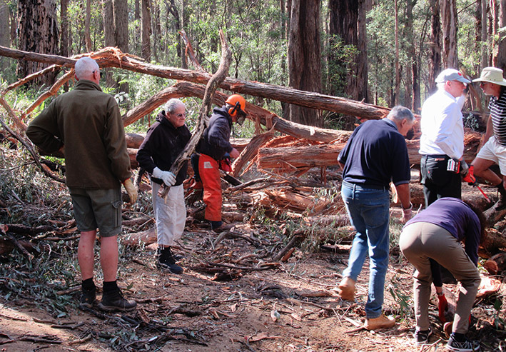
Rubicon River - Leaders: Colin and Heather
Six vehicles travelled through Peppermint gum and Mountain Ash with the sun glinting through the trees to discover the delights of the Rubicon River. We passed historical logging signs on the Big Stump and arrived at the Rubicon dam along a wonderful secluded track. The water was spilling over the wall in a most picturesque spot with steep valleys and ferns.
We then had a fruitless search for the elusive Whisky Creek Hut but the tracks were interesting and more sightings of the Rubicon river . The lunch stop was the Royston Power station with lots to explore including a viaduct and remnants of an old railway line. The engineers were in their element with machinery and information. We continued on following the Rubicon river with wonderful sightings of gushing rivers, dam and waterfalls to the end of the track. We were fortunate to find that the track was open at the Rubicon end and were able to return to the main road rather than returning along the same route. A most enjoyable drive.
Text and pic: Gill & Bill
Tuesday 26th November
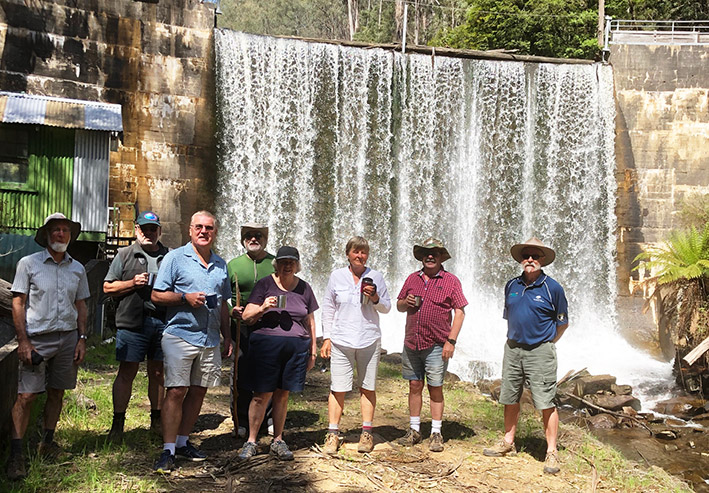
Keppel Hut - Leaders: Colin and Heather
Trip briefing done, TC appointed, radio channel advised and radio check carried out, we headed south out of camp towards Cathedral Range State Park. Travelling via Cathedral Lane and Little River Road, we arrived at the well-utilised Cooks Mill Camp where we turned on to Tweed Spur Road. This is one of the tracks members from our club have cleared ready for seasonal opening over the past couple of years, and it took us from Cathedral Range into Rubicon State Forest.
We then headed along Blue Range Road to Mt Margaret Gap where the plan was to take Lady Talbot Drive to Keppel Hut. Unfortunately the tracks in that area were closed preventing access to the hut, so Plan B was activated and we continued on to Mt Margaret Road before taking the steep drop down Eagles Nest Road to Marysville Road and into the township of Marysville where the trip was officially ended.
It had started to drizzle so we all headed indoors for lunch - some to the Marysville Bakery, some to other cafes - and each made their own way back for an early finish at camp in Taggerty.
Thanks to our trip leaders for a pleasant and enjoyable drive.
Text: Graham, pic: Heather
Cheviot Tunnel & Black Range - Leaders: Bill & Gill
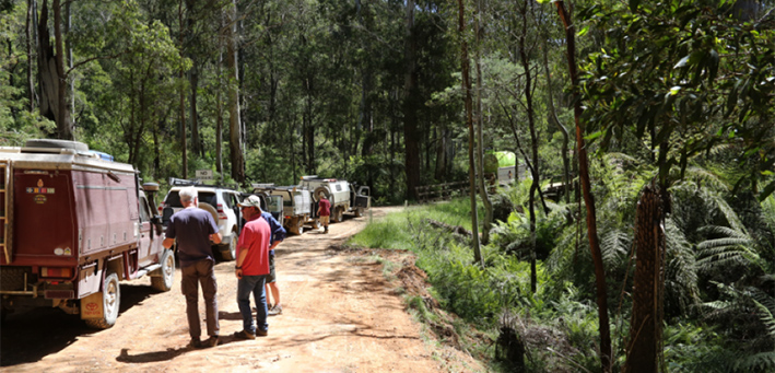
On a grey day, with showers predicted, seven cars left the Taggerty Caravan Park, on an exploration tour to the Cheviot Tunnel and Black Range State Forest.
Our departure was delayed a tad with the trip-leader's car keys missing – later found with his wife!! We travelled on the bitumen past Acheron, and onto the dirt at Whanregaren Road and on to the Cheviot tunnel via the very pretty White’s Road. Located midway between Yea and Molesworth, at 201m, the Cheviot Tunnel is the longest rail trail tunnel in Victoria and a key feature of the original Tallarook to Mansfield Railway Line. The rail line opened in 1889 and served the local logging industry. After walking the length of the tunnel, it was back on the road to the Black Range State Forest. We drove through some lovely forest areas, and there were some very interesting 4-wheel driving tracks. After lunch the rain came down and we even had some hail, which of course didn’t help the condition of the tracks. Unfortunately we had to abandon the latter part of the trip due to a large fallen tree and slippery conditions on Devastation Track, so it was back to our camp at Taggerty via Connelly Creek Road, Glendale Road, and the Highway.
Even though the rain shortened our trip, a great day was had by all, and a big thank you to our trip leaders who did a sterling job in the conditions.
Text and pic: Trish & J-P
Wednesday 27th November
Mt Samaria - Leader: Graham
Today’s drive was planned as an easy high-range scenic drive, and that was exactly what it turned out to be. The weather was perfect and after the light rain of yesterday, the roads were not too dusty. At least, not at the front of the three-vehicle convoy!
We headed north from camp to Alexandra then followed Maintongoon Road through farmland, forest and logged areas. The road in sections was in good condition but extremely narrow with blind turns and steep drop-offs to the side - nowhere to pass if we had met oncoming traffic. But the views as we dropped down towards Bonnie Doon were spectacular.
From the serenity of Bonnie Doon we followed the highway in to Mansfield where Mark and Felicity shouted the group morning coffee and vanilla slices at the Mansfield Bakery.
Back on the road, we continued north through Bridge Creek to Blue Range Road and onto Mt Samaria Road. This was a delightful drive through the length of the Mount Samaria State Park. We stopped to check out what remained of a timber mill kiln, and further along, to undertake the walk to the summit of the mountain at just under 1000m. This turned out to be quite a steep climb, but with bright red faces and much puffing and sore muscles, and after many rest pauses, most of us made it to the top to take in the view over Lake Nillahcootie far below. The return descent was unsurprisingly much easier and we enjoyed lunch back at the carpark.
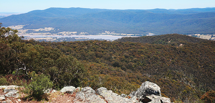
Continuing north, we came to Williams Road which took us west to the Midland Highway. We stopped in at the Lake Nillahcootie Scenic Reserve where we decided that since time was getting away from us, we would skip the originally planned route through the southern part of Strathbogie State Forest, and head straight down the highway and back through Bonnie Doon. From there we followed a different route along Coles Road and Spring Creek Road back to Alexandra where the trip was officially terminated. Each of the vehicles then made their own way back to camp at Taggerty concluding a round trip of 200km.
Text and pics: Graham
Exploring the Lake Eildon Environs - Leaders: Colin and Heather
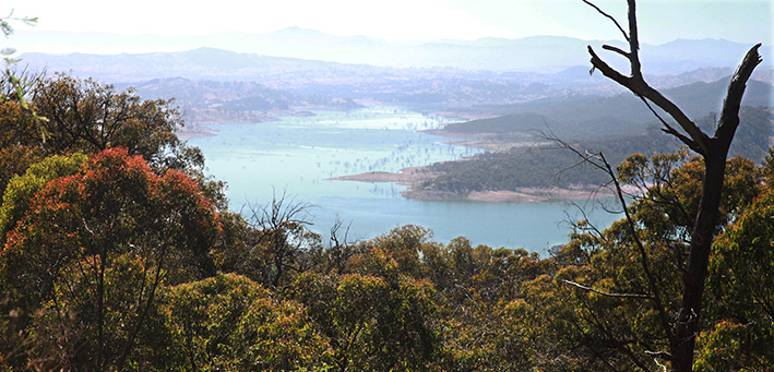
Mallets Track off the Eildon Jamieson Road was the starting point for our drive through eucalypt forests with an easy climb up to 560m and descent to our only river crossing over Knowles Gap Creek. Here we paused to admire the new fences erected by Club members to protect the bush from vehicle damage. We took Taylors Creek Track to climb up to Wombat Track which runs along the ridge over Wombat Knob and along to the highest point, Peters Peak at 789m. Morning tea was enjoyed a short while later with views through the trees of Lake Eildon.
The descent to the lake via Webb Track was fairly steep and soon we were exploring the barren lake edge featuring the dead trees. The climb back up Rhonda Track was a bit more of a challenge with some vehicles having to revise their approach to two close jump-ups with loose clay surfaces – they would have been much more of a challenge in the wet. We returned via Taylors Creek Track to the Wilson Creek Track to see if we could find the puzzling ‘Pudding Ring’ and the Wilson Creek Hut and Crusher, but they remained a mystery.
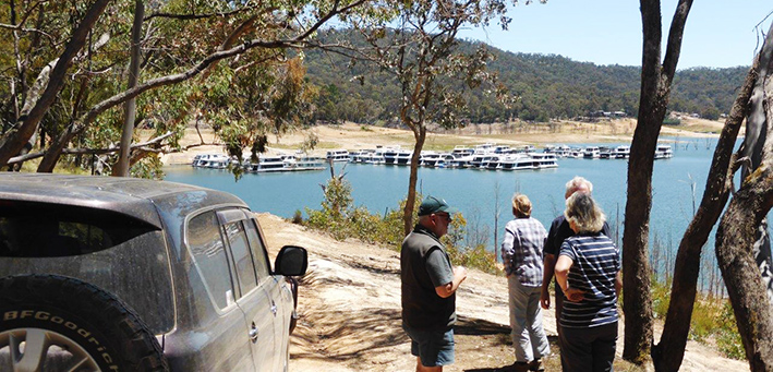
Lunch was taken opposite the Darlingford Waters Marina where dozens of house boats are moored. We followed the Jerusalem Creek Track to get to Foggs Lookout for views over Sugarloaf Dam and the second longest high voltage powerline span in the southern hemisphere at 2250m across Lake Eildon. We were then given the option to tackle Steep Track or an alternative less steep track, but there were no takers for the alternative. The steep rocky descent proved to be within everyone’s capabilities.
Taggerty to Taggerty 109km, 5 hours of driving, average speed 24kph.
Text and pics: Paul & Tineke
Thursday 28th November
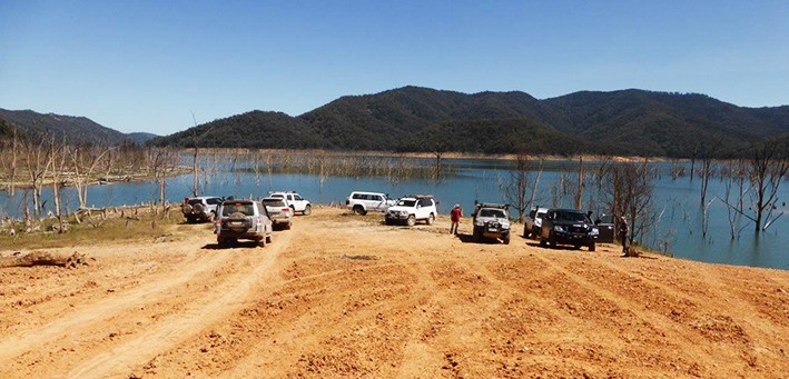
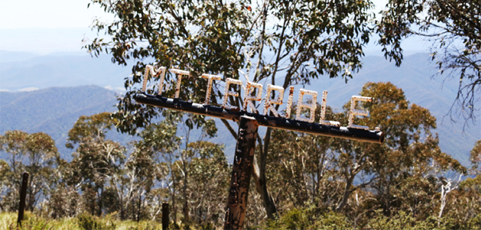
Mount Terrible - Leader: Uwe
The day started with a trip briefing by Uwe at 08:15 at the Taggerty Big 4 Caravan Park and promised an “easy” trip to the summit of Mt Terrible and a stop for afternoon tea on the way home at the Marysville Bakery for a vanilla slice (highly recommended by the trip leader).
The convoy headed south on the Maroonadah Highway (B360) towards Buxton, followed by the C508 towards Marysville and then east on the C513 / C511 towards Woods Point. Shortly after the Cumberland Junction, the convoy turned off the bitumen and headed north on the graded gravel Eildon Warburton Road where we stopped to air down. Soon on the move again, the convoy turned on to Big River Road.
We reached Stockmans Reward (09:45) for a morning tea stop. Under way at 10:20, we continued on Big River Road, soon meeting a road maintenance crew (grader, roller and water truck) and were forced to wait for a minute or two while the water truck filled its tank on the single lane bridge over Frenchman Creek.
Once under way again the road deteriorated quite significantly, which was a foretaste of the very rocky tracks to come. At 11:06 we turned on to the Mount Terrible Track and then followed its continuation into the National Horse Trail to the summit of Mount Terrible. The track included some steep and rocky sections requiring low range four wheel drive, climbing from an altitude of ~710m to 1612m (above sea level).
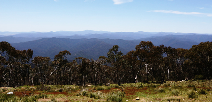
We reached the summit at 12:10 where we enjoyed magnificent views and a self-catered lunch.
Under way at 13:00 we descended via Newmans Track and Danes Spur Track until reaching Big River Road, from whence we headed south until retracing our route back to Taggerty, arriving at 16:08. The return trip included a longer delay at the one way bridge over Frenchman Creek while the road maintenance crew again filled the water truck from the creek.
Unfortunately there was no time for the desired vanilla slice / afternoon tea as we were all focussed on getting ready for the evening meal at the Rubicon Hotel at Thornton.
Many thanks to Uwe and the trip participants for a great and safe day out!
Distance travelled: 190.5km - Elapsed Time: 8 hours - Altitude Range: ~1,100m
Text and pics: Mark & Felicity
Mansfield State Forest - Leader: Daniel
We set off on a sunny day heading south towards Buxton and turned off on Gypsy Lane. Tyre pressures were reduced before we headed along Perry Track. We saw kangaroos cross the track as we negotiated spoon drains in low range. We went through a very pretty fern gully. We travelled on Triangle Road, Worcester and South Palmer Tracks among others before heading for Woods Lookout. Big rocks prevented us reaching the top. As one member of the group said, the only vehicle which could have reached Woods Lookout without damage would be a bulldozer. We wandered along other tracks and reached Marysville in time for lunch. We commented that if the tracks were wet some of them would be very difficult to negotiate.
The highlight after lunch was to visit the Mt Gordon Telecom and Fire Tower. We had distant views of the Mountain Ash destroyed in the 2009 bush fires. We enjoyed a talk with the friendly fire spotter.
Then, it was homeward bound back towards Granton and a shorter route along Pitts Track and North Creek Road to the Maroondah Highway. We did approx. 100 kms.
Text and pics: Monica and Keith