Tuesday 11th May 2021
Leaders: Paul & Tineke
Participants: Wayne, Phil & Gill, Bill & Gill, Mark & Felicity, Colin A, Peter B.
A total of 11 members in seven vehicles met at the Gembrook Bakery at 09:30 for morning coffee and the trip briefing for an exciting bush adventure exploring the Kurth Kiln, taking in great views from Egg Rock, enjoying great forest driving via the Old Beenak PO Tree with a few short steep downhill and uphill sections on the way to Powelltown.
Those arriving earlier than others were treated to a very crisp morning and a gathering of Victoria Police (probably doing a training exercise) while the remainder of the group slowly gathered being delayed by rain, mist and heavy traffic. Fortunately, the baked goods on offer at the Gembrook Bakery – including both regular and French vanilla slices – were of great quality, the coffee good and the atmosphere very warm.
The trip rating was “medium” with guidance to prepare for mud and a short, rutted section. With all members assembled, the trip briefing (vehicle order, Tail-end Charlie and report writer selected, general instructions) given, the convoy departed Gembrook at 10:00 heading east and then turning northwards onto the Beenak Road for the 5km / 8 minute drive to the Kurth Kiln picnic area, where we aired down.
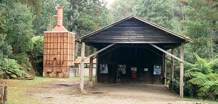
Here we inspected the only known almost intact charcoal production kiln of the 40 or so constructed by the Victorian Government in 1942 designed by Dr Kurth (he was paid £5 for the design). The charcoal was used to power motor vehicles during the second World War as an alternative to the very expensive and rationed petrol supplies. There is an excellent entry on Wikipedia on the Kurth Kiln.
The convoy left the Kurth Kiln picnic ground at 10:55 continuing north on Beenak Road and then turning east onto Soldiers Road passing through mixed forests. A very pleasant drive continued through patches of mist and intermittent rain. We then turned south onto Tomahawk Valley Road passing underneath the high voltage transmission lines and the access to Egg Rock fire tower which was shrouded in mist.
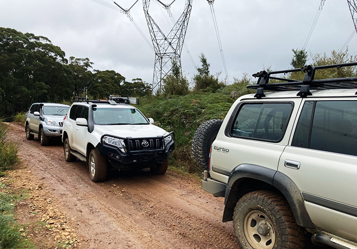
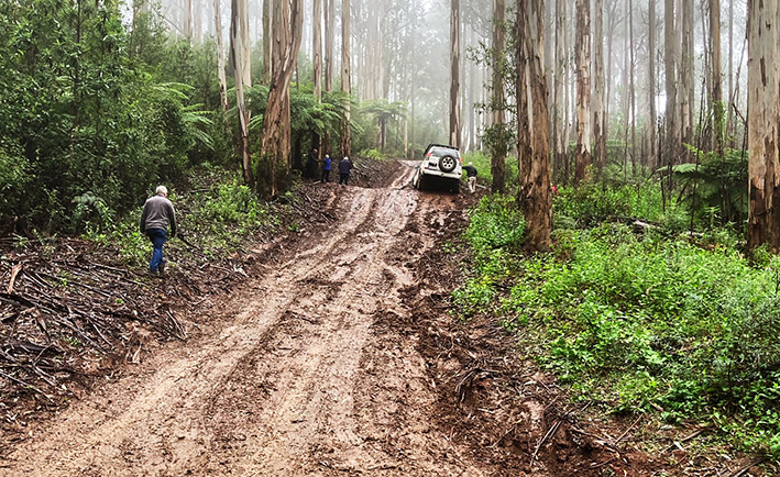
The road swung from travelling in an easterly direction toward the north east and became Beenak East Road. At the Tomahawk Gap T-intersection (left: Beenak Road) we turned right into Blue Ridge Drive and then right again onto Little Bunyip Track heading south. The track descended quite steeply with a few muddy / boggy areas that were very slippery, requiring great care to control the vehicles, passing again under the high voltage transmission lines. We all gathered at the bottom of the descent before heading off again.
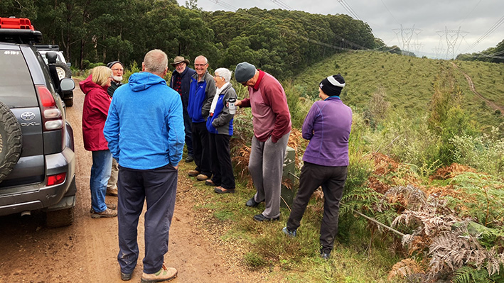
The Little Bunyip Track turned towards the east passing for a third time under the high voltage transmission lines and lunch stop was called on the track just after midday where we could take in the views.
Progress on Little Bunyip Track resumed at approximately 12:30 heading towards the east. At the next T-intersection we turned north / left onto Anderson’s Track to climb out of the valley and meet up with Blue Ridge Drive. Andersons track is marked in Rooftop’s Gembrook Powelltown Forest Activities Map as “Claimed to be the most difficult 4wd track in the park but don’t agree (Tk has a few steep sections with a bit of mud, would be difficult in wet conditions)” but we made good progress for about 2.3km including some steep sections until the trip leader, when attempting the final section of a steep climb to the T-intersection of Blue Ridge Drive and Range Road, lost traction and slid downhill to the last spoon drain at approximately 12:56. This induced an extremely visceral response for the trip leader and his passenger as well some who observed the 15 seconds of almost completely uncontrolled descent. Some sharp instructions were broadcast over the UHF to not get too close. It’s a credit to the health of those in the vehicle that their hearts and all those other body parts that respond exquisitely to adrenaline that no additional adverse outcomes were observed following this event.
The trip leader’s vehicle had fortunately come to rest undamaged and parallel to the track, but at the very edge of a drop off at 90 degrees to the track. With the convoy stopped, many trudged up the very slippery track to assist in the recovery for the next 50 minutes or so. The vehicle’s winch along with track-side trees used as anchors were used to first winch the vehicle up the track a few metres, and then back down the track until traction was once again possible. A total of three separate winching episodes with suitable tree anchors were required for a controlled descent distance of 60m before sufficient traction was attained for the vehicle to be driven.
The convoy then descended Andersons Track to the T-intersection of Little Bunyip Track for a regroup and trip plan revision. The decision was made to abandon the remainder of the trip to Powelltown and head back to the Gembrook Bakery for refreshments.
The convoy left the intersection at approximately 14:05 southwards on Andersons Track then turning right / west onto Black Snake Creek Road, then south onto Beenak East Road, and then right / west onto The Pack Track. The Convoy stopped in a safe spot on The Pack Track to air up, which was completed at 15:00. The trip was officially declared complete at this time.
The majority of the trip participants regrouped for coffee & teas and wonderful baked good at the Gembrook Bakery.
Trip statistics: Distance: 44km; Time: 5 hours; Average speed: 8.556 km/h; Maximum altitude: 620 metres
Text and Photos: Mark