Otway Forests - Wednesday 27th April 2022
Leaders: Phil and Gill
Participants: Gary and Leanne, Ray and Maz, Graham, Bill and Gill, Mark and Felicity, Colin and Heather, Daniel
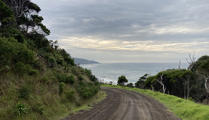
We met at Lorne SLSC, had a trip briefing and a cuppa on a partly cloudy, pleasant 18 degree day. The eight vehicles left at 10 am travelling southwest along the Great Ocean Road.
We were stopped at road work traffic lights and this gave us the opportunity to take in the beautiful ocean views.
At Kennett River, we did a right hand turn into Hawdon Ave and again at Grey River Road. Most vehicles took the opportunity to air down. Gill A informed us that along this road is where she brings her overseas guests to observe koalas, usually prevalent in this area but only one observed on this day.
Continuing on Grey River Road we entered Great Otway National Park and found an old fire bunker (info given by the Ranger) used by timber workers in the past, as well as relics of logging machinery.
Later on there were numerous examples of tree stumps where planks had been used by the timber fellers.
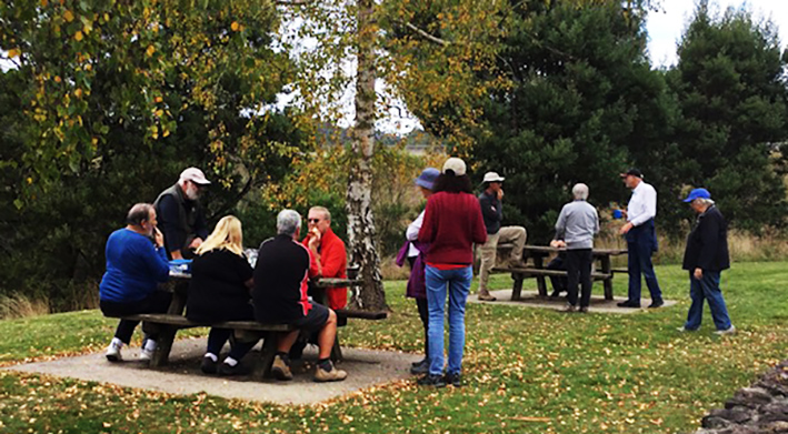
We took a left turn at Benwerrin-Mt Sabine Rd taking in beautiful scenery of tall timbers and tree ferns. After joining Sunny Side Rd, we took a right turn into Forrest-Apollo Bay Rd. After stopping at the West Barwon Reservoir lookout to take in the view, we continued to the reservoir for a lunch stop.
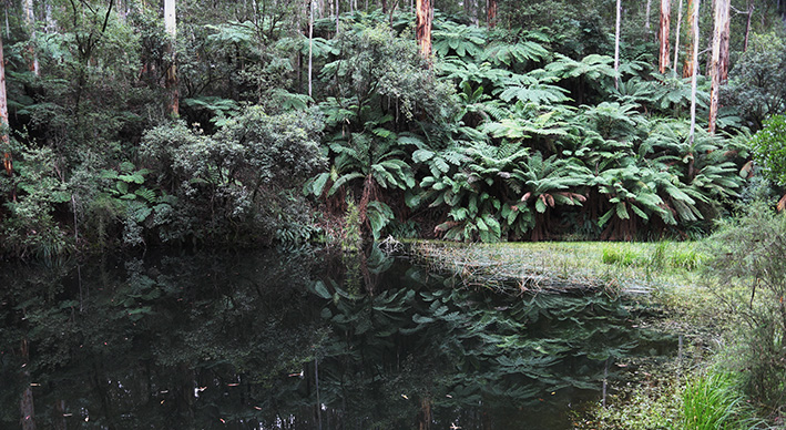
Travelling south through Forrest on Kaanglang Rd, we made our way to Lake Elizabeth. Some took the 1.2km walking track into this fresh water lake. Some leeches (not our awesome trip leaders) took a free ride on some of our party!
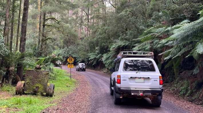
Continuing on Kaanglang Rd, we re-joined Benwerrin-Mt Sabine Rd, taking a left turn into Kennett Rd. It was great to get onto a 4WD track. The trip plan had been to drive more 4WD tracks but we were unable to do this as tracks had closed gates due to fuel reduction burns and earlier rain events. This was quite a good descending track, a few slippery spots and a few washouts. On approaching the Great Ocean Road intersection, we stopped and, as a group, made the decision to end the trip there. While stopped, leeches made their presence felt once again!
Our 88.7 km trip ended at Kennett River roadside around 3:15 pm. Most agreed to meet later at the Aireys Inlet Pub for dinner.
Text: Ray and Maz
Photos: Ray and Maz, Mark
Angahook-Lorne State Park - Thursday 28th April 2022
Leaders: Bill and Gill
Participants: Gary and Leanne, Ray and Maz, Graham, Phil and Gill, Mark and Felicity, Colin and Heather, Daniel, Paul and Tineke
At 9:45 am, on an overcast morning the group gathered at the Airey's Inlet Reserve (opposite the "Strapper Surf" shop) for a trip briefing. The trip rating was originally "medium" but upgraded to "difficult" because of the forecast rain and track closures. Bill had sought advice from the Parks Victoria Ranger on track conditions but had not succeeded in contacting anyone. There were no late changes of plan, so the convoy left the reserve and headed south on the B100 (Great Ocean Road) towards Lorne. After a short distance we turned right on to Golf Links Road and then on to Coal Mine Track. Coal Mine Track was predicted to be wet and boggy but the few puddles we discovered didn’t cause any delay.
The convoy turned left onto Moggs Creek track which was a good drivable track, and by 10:35 am, reached the junction of Moggs Creek Track and Gentle Annie Track where we observed a number of road making / earth moving machines.
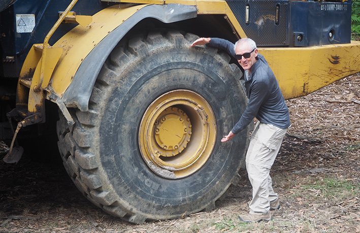
While we were inspecting the machines one of the elusive Parks Victoria Rangers appeared from the east / closed section of Gentle Annie track and informed the leader that significantly more machines were working lower down the track.
After a thorough inspection of the large and impressive roadmaking machinery we turned to the west along Gentle Annie Track. This led us to Seaview Road and then on to the bitumen of the Deans Marsh - Lorne Road (C151).
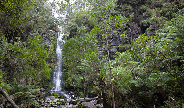
Shortly after 11 am the convoy left the sealed highway and turned left into the "Big Hill" camping area for lunch. After lunch we left the camping area turning left onto C151 then immediately right onto the Benwerrin - Mount Sabine Road. The road is a dividing line between Great Otway National Park on the left / south and the Otway Park on the north / right. We then headed to Erskine Falls Road and when we arrived at the falls everyone walked down to the first viewing platform to see the magnificent falls in good flow. Many walked down the longer set of stairs to the bottom for an even more impressive view.
Leaving Erskine Falls we retraced our route back to the Benwerrin - Mount Sabine Road turning left onto it. Next, we turned left off the Benwerrin - Mount Sabine Road onto Sharps Road and descended through the forest into Lorne. The track had some steep-ish descents and a number of muddy / slippery areas where some "boys" had been making bogs - possibly over the Easter weekend. Nevertheless, these areas, even though somewhat slippery didn't present any difficulty to the convoy and we safely arrived at the Lorne Surf Life Saving Club carpark at 2:33 pm. In all, the trip covered a distance of 68.6kms.
Text: Mark and Heather
Photos: Mark and Graham