Tuesday 21st February - Friday 24th February 2023
Leader: Gary
Participants: Colin, David, Ed, Felicity and Mark, Paul and Tineke and Uwe
Day 1 - Tuesday
Dargo to Talbotville including visits to abandoned mines: "Jeweller's Shop" and "Union Mine”.
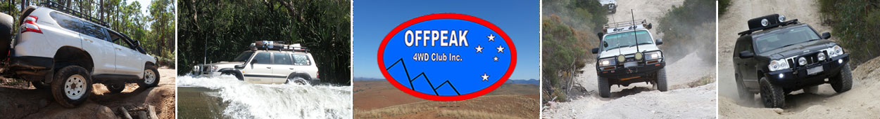
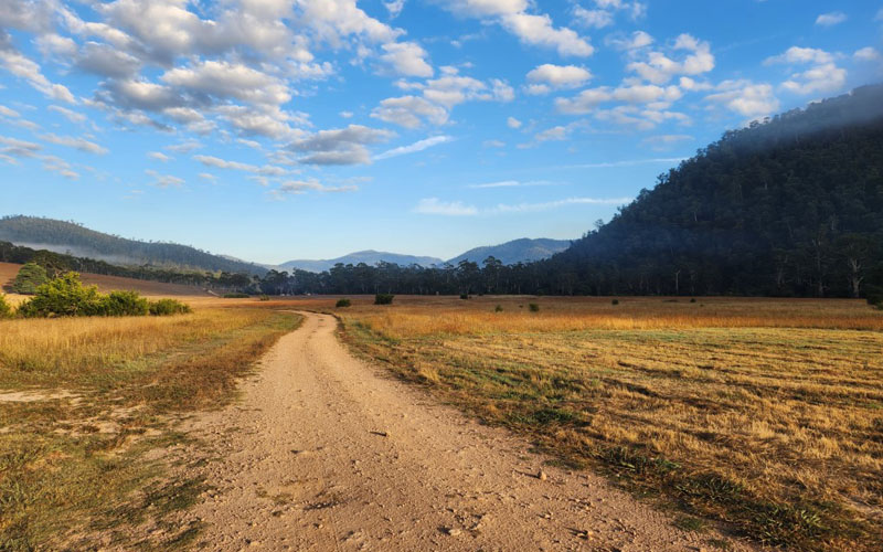
For most of us it was a four-hour trip to the starting point, the Dargo Pub. One party was late their excuse being roadworks and wet roads, but there was time for lunch before the trip briefing. We wound up the Dargo High Plains Road to McMillan Road, the start of the gravel tracks and an ideal place to air down. Grant Cemetery was our first stopping place of interest, a short walk around the overgrown bush track to the few marked graves and numerous unmarked ones.
Grant townsite, which originally had a population approaching 2000 in 1890 was our next stop. Very little remains today and locations of original buildings are marked with plaques in the long grass.
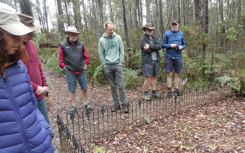
Gary then led us down the Union Spur track to see the entrance to the Jeweller’s Mine, and a bit further on we entered the Union Mine adit. We weren’t the only ones there as there was fresh evidence of wombat habitation. We explored the first 200m of the adit before an old rock fall stopped us. We didn’t find any diamonds or gold, but in places fine roots were showing through the adit roof and they were covered in mosquitoes!
The Bulltown Spur required the use of low range as the steep descent took us to the Crooked River Track followed by the 24 enjoyable crossings to get to Talbotville. The water depth was mostly just half a wheel.
Soon after arrival, Gary disappeared into the bush with his favourite toy and came back dragging half a tree which required the use of his second favourite toy to prepare it for the evening around the campfire. A great start to the trip.
Stats for the day:
- Distance Driven: 38.56km
- Driving Time: 4:09:36
- Average Speed: 9.3kph
- Maximum Altitude: 1,239m
- Minimum Altitude: 204m
Text and pics: Paul and Tineke
Day 2 - Wednesday
After a mild and quiet night at the Talbotville camping area, the object of the day was to drive to Wonangatta Valley and take in a number of interesting sights and side trips.
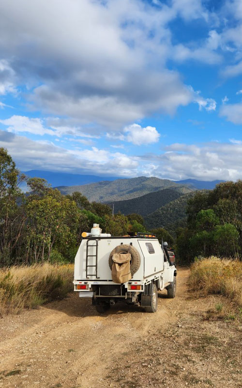
The group left the campground at 9 am and proceeded southeast along the Crooked River Road fording the Crooked River a number of times before turning towards the west onto the Cynthia Spur Track and then onto the Cynthia Range Track at 9:30am. Both of these tracks were quite steep with plenty of long & steep climbs and descents, but fortunately the track was dry and in good conditions. At 9:45 am we reached the “top of the world” helipad. Fortunately, we had a clear run over the trickier parts but did meet traffic at the junction with Eaglevale Track – fortunately there was sufficient room at the junction for an easy negotiation. The views along this route were amazing.
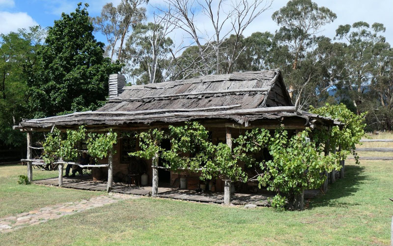
We proceeded down the Eaglevale Track which was again replete steep descents and another water crossing as we entered the Eaglevale campground at 11:10 am for morning tea. After morning tea, we took a track to Harry’s Hut (having been granted permission) at 11:40 am. Harry Smith’s Eaglevale Hut was built circa 1870 and restored by Jim Worsley and “crew” between 1989 and 1991. We were greeted by the some of the now much older restoration crew who were on site to perform maintenance very happy to be our guides. It was wonderful to have the history explained that made it come alive.
We left Harry’s Hut an hour later and returned to the Eaglevale campground for lunch. Lunch was over at 1:20 pm and we set off back the way we came for another steep climb to the junction of the Eaglevale, Cynthia Range and Wombat Range tracks. This time we turned onto the Wombat Range Track at 1:40 pm. The track was in good condition with the altitude above sea level about 1,000m, but the descent to the Humffray Harts Spur Track was 480m in just 2.6km of track.
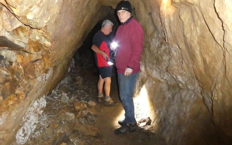
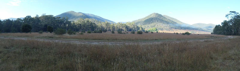
We were soon on the Wonnangatta Track (Upper) heading for Wonnangatta Station to find a campsite for the next two nights. A few fords later and passing the Elms camping area we found a quiet sport along the banks of the Wonnangatta River arriving at 3:45pm.
Stats for the day:
- Distance Driven: 63.77km
- Driving Time: 6:40:40
- Average Speed: 9.55kph
- Maximum Altitude 1,190m
- Minimum Altitude: 251m
Text and pics: Felicity and Mark
Day 3 - Thursday
Rest Day (explored the Wonnangatta Valley via foot).
Day 4 - Friday
This was to be the final day of our already amazing Wonnangatta Wandering High Country 4WD trip. The plan for the day was to pack up and depart from our lovely campsite by 9:00am. Then, we would drive out of the Wonnangatta Valley via Zeka Spur Track up to the Howitt Plains and out of the National Park to Licola.
Our bush alarm was set to 6:00am and the obliging Kookaburras did not let us down. However, it seemed that most of the group hit their snooze buttons for a little more sleep. That was understandable as the cooler overnight temperature provided favourable sleeping conditions.
The early birds in the group were rewarded with the awakening of the Wonnangatta Valley and especially the changing colours as the sun rose over the mountains.
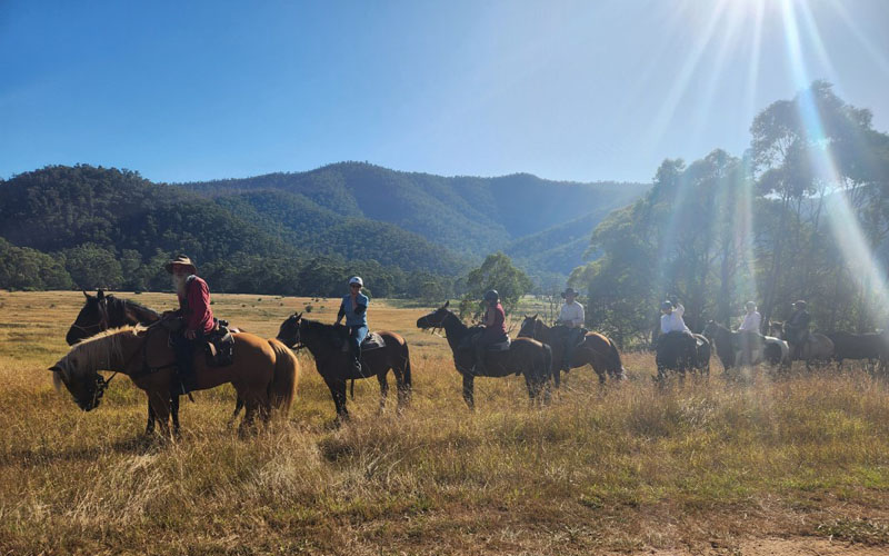
Having finished our camp pack-up, inhaled our breakfast and completed our morning rituals, it was time for our daily trip briefing. It wasn’t long before we were strapped back into our vehicles and once again in convoy formation. As we had driven into the Valley via Wombat Range Track a couple of days earlier, we drove out via Zeka Spur Track. Therefore, we drove along Wonnangatta Track and turned into Zeka Spur Track. Before doing so, we crossed Dry River which was more than a contradiction of terms. We were also fortunate enough to see a horse-riding tour ambling along, which looked like another great way to experience our wonderful High Country.
Zeka Spur is always a fun and interesting track on which to drive. While not particularly challenging, it has some small challenging, steep and rocky sections to keep you focused. During our climb, we came across another convoy descending into the valley. They were kind enough to pull over to allow us an easy passage to pass. The final section of Zeka Spur opens up to vast views of mountains for as far as the eye can see. We were particularly blessed with an amazingly clear day.
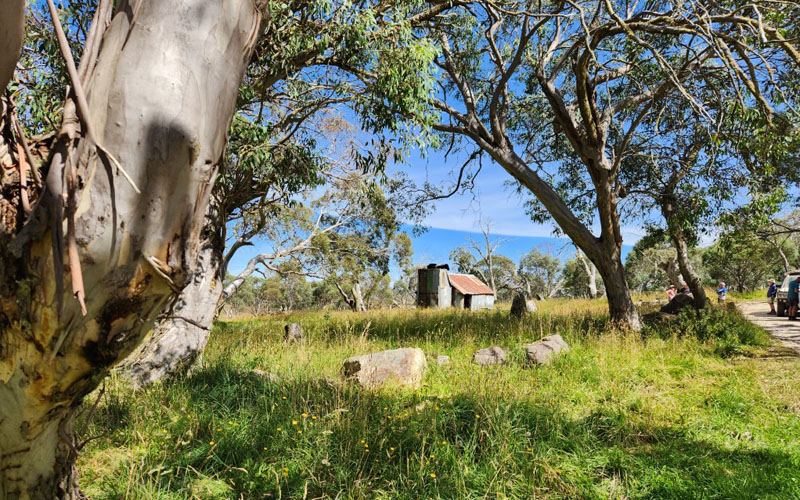
We had a quick morning tea stop at Howitt Hut. This is a fantastic location with much history and amazing views across the open plains.
We then drove down the unsealed track that is Howitt Road, passing the Snowy Plains Airstrip. At an altitude of 1600m, it is one of the highest airstrips in Australia. Next, we turned off onto Kelly Lane, a great way to break up the dusty drive. We visited Kellys Hut, another iconic High Country hut worth visiting. Our lunch stop was a little further along Kelly Lane at a nice little creek crossing and billabong.
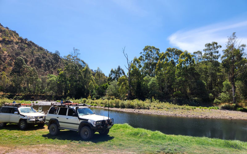
The final leg of our trip was to turn back onto Tamboritha Road before stopping along the Wellington River to air up. At this point, we felt the day’s heat. All was right when we found a swimming hole for a cooling off drip. It was at this point that the trip was acknowledged as complete. Some of the group proceeded to Licola for an ice-cream before the drive home. An amazing trip was had by all and special thanks to Gary for organising and leading this trip.
Stats for the day:
- Distance Driven: 104.77km
- Driving Time: 5:42:04
- Average Speed: 18.37kph
- Maximum Altitude: 1,652m
- Minimum Altitude: 226m
Text and pics: David