26th August to 6th September 2025
Leaders: Paul and Tineke
Participants: Richard and Maria, J-P and Trish and Tony
Tuesday the 26th August
The campground at Leigh Creek was a bit bare and the facilities were part of the old accommodation available to workers there. Some of us went to the pub for dinner and we all met there later for the first trip briefing. Our first stop was the Copley Bakery where we sampled their quandong pies and inquired about track conditions. We were told that the tracks were very rocky and sharp and put 50 PS I in your tyres. We ignored their advice and soon after leaving aired down. Our morning tea stop was by Finke Creek where there was a memorial to Gertrude Johnson dated 1919. Lunch stop was at Weetootla Gorge and the 5km track in there was quite good. We walked up the gorge for over a kilometre having missed the sign which marked the entrance to the gorge. The road to Arkaroola was in excellent condition and after checking in we set up camp in the rocky campground.
Wednesday the 27th August
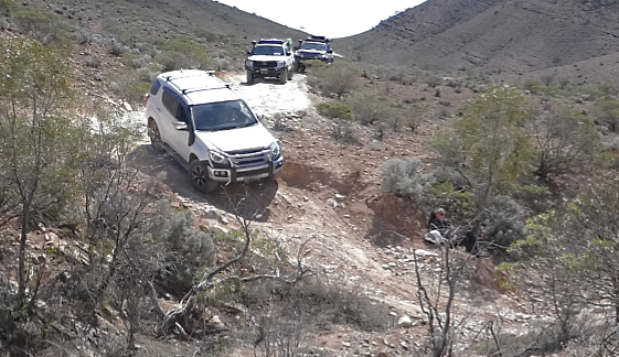
After a very windy day and night, bright sunshine greeted us when we set off from camp around 9:00 AM. We went back down the Arkaroola Road to the Mount McTaggart track, then tackled the Worturpa track in an anticlockwise direction. This track was quite challenging with some steep descents. Quite a few wildflowers in bloom including Sturt desert peas, lots of dead trees and some lovely rock faces. During the trip we visited Gill’s lookout Grindells Hut and on our return we attempted to find the bat caves but later learned that they were closed. A lovely day was had by all, except for one emu we left behind with a monster headache after it cracked a windscreen.
Gill’s Lookout on the Warturpa track – room at the top for just 2 cars
Thursday the 28th August
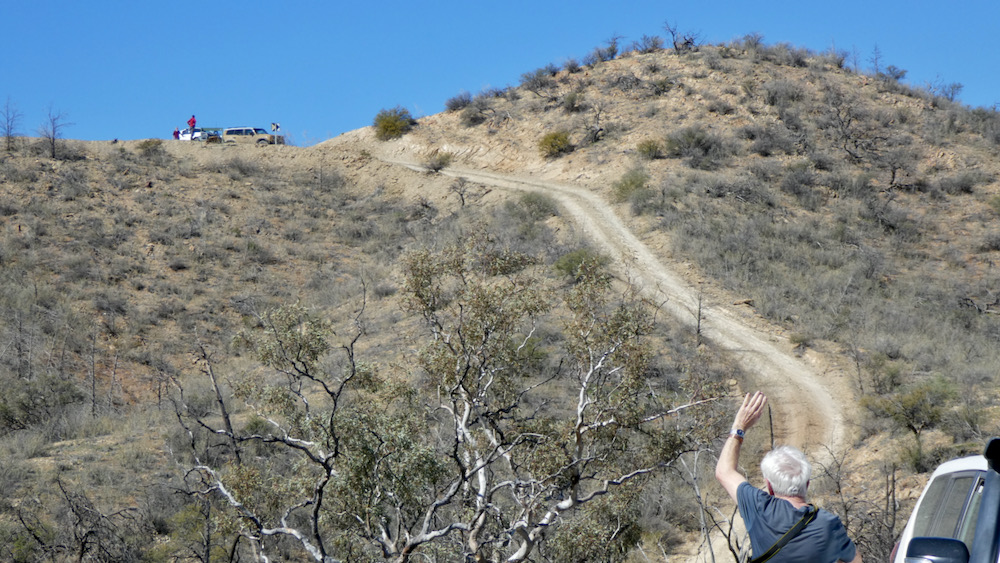
We all met at the village shop and paid our $45 per car and one of us paid an extra $50 bond for the key and departed at 9:00 for the Echo Camp Back Track. We all received self-drive guides suggesting a duration 4 to 5 hours. We stopped at the cairn dedicated to Sir Mark Oliphant the Governor of South Australia from 1971 to 1976. He was a scientist and had a role in Britain and USA in their construction of the atomic bomb. He was overwhelmed by the destruction caused and he entreated mankind to renounce destructive uses of atomic energy. The mountain behind the cairn was Mt Oliphant. We didn't see any yellow footed rock wallabies at the water hole or anywhere all day despite searching every rock cave we saw. We went to the historic site of William Bentley and his son Smiler who leased the Battlers Block in 1931 with the proviso that they rid the block of dingoes.
Battlers Block Memorial
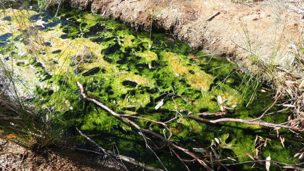
It was eventually sold onto Reg Spriggs in 1948. At the start of the one-way track, we had morning tea at 10:30. We looked for the actinolite rock and found it after a rocky creek crossing. We saw quite a few emus, some kangaroos, we gazed at dry Lake Frome from the lookout and went on a fairly rough track to Paralana Hot Springs. They were indeed hot! Vadaardlanha - meaning dead finish fire - an aboriginal dashed his dead finish firestick into the spring which remains bubbling with hot water to this day.
Paralana Hot Springs
We passed through Claude’s Pass named in the memory of Reg Spriggs’ father Claude. Then came Stubbs Waterhole that had little water but had two caves with aboriginal art in them. The Welcome Pound stretched below us. Not far from home we looked unsuccessfully for the native orange trees but found the ochre wall which was quite amazing with its lines of different stripes horizontally of all the ochre colours. It was a great day. The flowers we all took photos of were wild parsnips.
Friday the 29th August: the Mt Jacob Backtrack
This track starts with the Ochre Wall which we visited yesterday but our first stop was Lively's Find, an old gold mine. There were two mine shafts and the remains of his dwelling to see. We moved on to the Welcome Mine which had two deep shafts and long trenches, and it was hard to work out what the trenches were for. We continued north to the start of the Mt Jacob Backtrack. We took a short walk to the Tillite Gorge, a specific type of conglomerate. It was a rough walk, but the gorge was spectacular. As we continued south the track turned rougher and there were dry creek crossings and washouts to negotiate. Three lookouts were mentioned in the guide, but they were very steep, so we walked up two of them to see the spectacular views. We didn't find the third lookout. The track deteriorated to a very rough and rocky condition. It was very slow going at times. After a few kilometres we reached the main road and made our way via the Station Backtrack back to camp.
A little challenge on the Mt. Jacob Backtrack
Saturday the 30th August
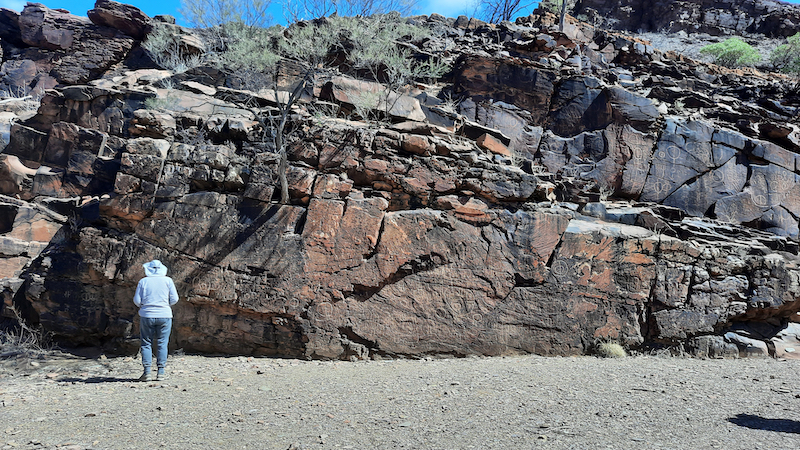
Another very cold night however the strong winds have abated, and it was lovely and sunny. Today was a day for moving camp from Arkaroola to Alpana Station. On the way we stopped at Wearing Gorge for morning tea and then lunch at Chambers Gorge, where several of the group walked up the gorge and saw a wall of petroglyphs.
All the dirt roads we travelled on today were in excellent condition. We arrived at Alpana around 3:30 PM and set up camp next to a dry creek bed with nearby long drop toilets. The ‘ensuite’ showers were about 800m away, but only available for our first night.
Sunday the 31st August
We left camp at 9:15 and travelled along the Flinders Ranges Way to Blinman and then on to Angorichina Village for fuel. Back on the gravel to the Parachilna Gorge where we passed many campers on the way. Lots of motorbikes going each way (The postie motorbike club were having a few days riding in the Flinders Ranges.) We turned into Glass Gorge Rd which had been recently graded. After morning tea, we turned on to the Moolooloo Rd to Ferguson's Gorge. We couldn't go to the Nuccaleena mine ruins as it was closed due to an accident where a woman had to be helicoptered out. The road to the Artimore ruins had many gates for Tailend Charlie to close. The extensive native pine forest was magnificent. The track ran beside and in the riverbed past Hannigan's Gap and by the time we got to Artimore ruins it was time to stop for lunch. We continued on to Narrina Rd which took us back to towards camp but as we had phone reception at Blinman we stopped there to make calls and catch up on emails. A truly lovely day out!
Monday the 1st September
After discussion it was decided to alter our schedule and transport straight to Willow springs, set up our vans and explore without them. First stop was the Great Walls of China, a surprising rock formation along a high ridge which did in fact resemble the Great Walls of China. After setting up our vans we continued to the Bunyeroo Valley Geological Scenic Drive. We stopped at Yanyanna Hut which is also where the Heysen trail intersects. After a group photo we stopped at two of the lookouts which gave us the iconic Flinders Ranges view of rugged mountains. Front and centre was St Marys Peak, the highest point. We enjoyed a short walk in Bunyeroo Gorge where massive red gums were prolific. We soon met the road to Brachina Gorge and enjoyed the spectacular rock formations. On the way we saw quite a few yellow footed wallabies at the foot of scree slopes. Happy hour was held on the top of Stokes Hill Lookout while we watched the beautiful sunset.
Tuesday the 2nd September
After another freezing night we were all up and ready to do the Skytrek by 8:00 AM. This 4x4 trip is well worth while doing and the management at Willow Springs are to be congratulated for making the route. We were issued with a comprehensive sheet of attractions. Each item of interest had a number description in the brochure which was most helpful. The journey included ruins of old shepherd’s huts, ochre cliffs, aboriginal etchings, the original Willow Springs water hole and a panoramic view of the iconic Wilpena Pound from Upalinna lookout. One of the hazards was driving uphill into the sun with almost zero visibility of the challenging track. A very slow strip, as we arrived back at 4:15 after travelling at total distance of 79 kilometres.
Wednesday the 3rd September
Today was a free day, but at some stage we all visited Wilpena. Our exclusive campsite was somewhat shaded by the native pines and because it was unpowered, we all suffered battery problems but ended up fixing them using our solar panels. Ah, the joys of modern camping!
Thursday the 4th September
Our first stop was at the famous Cazneaux tree photographed first in 1937 when he and his wife and son were camping there. We drove into the Arkaroo Rock car park but as the walk was two hours return up a steep track, we did not have time to visit the rock art there. We stopped at Hawker and most of us visited the amazing artwork and memorabilia displays by Jeff Morgan. Well worth the visit to see his displays which he developed over the last 30 years. It was also our lunch stop. Bendleby Ranges had powered sites available, so we took advantage of that, and also the provided redgum firewood which kept us warm for the two nights there.
Friday the 5th September
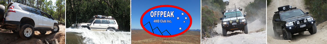
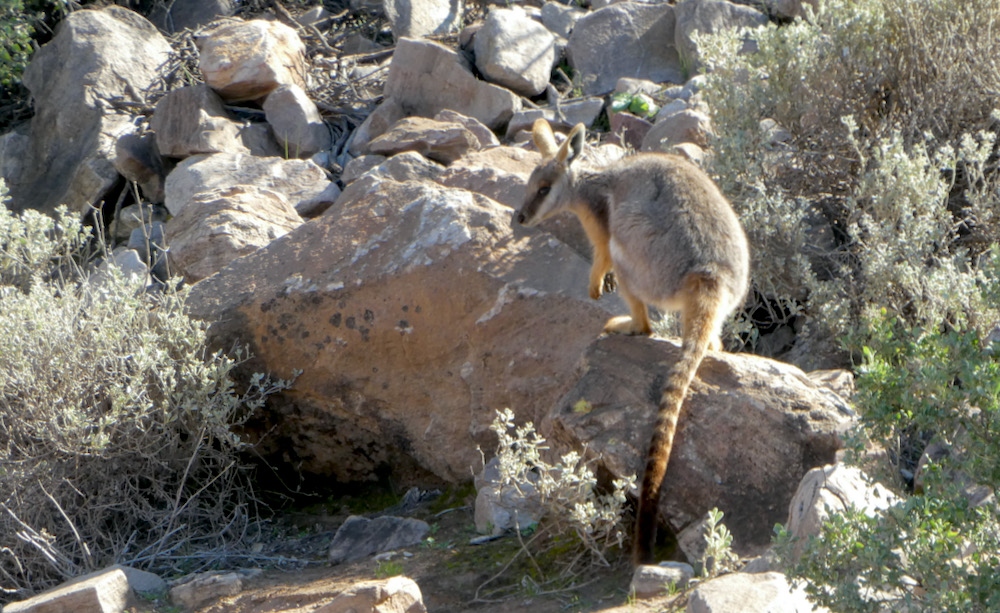
We were given the options at $80 per day to drive on the Bendleby Ranges 4WD tracks or the Hungry Ranges 4WD tracks. After being informed about the difficulty of the tracks in the Hungry Ranges, we settled for one day in the Bendleby Ranges. We heard a comment from one visitor “I’m glad I went as a passenger to the Hungry Ranges and not in my own car. 1½ hours to drive 2km of Billy Goat Ridge”. Our Bendleby Ranges drive of 41km took us 3¼ hours averaging 13km/hr, but it was interesting with great views, more pine forests and some shorter sections of challenging rocky creek beds. Gum Gorge Road was another red gum delight, and as we climbed, we were more exposed to the strong wind, so down in the valleys was the best place for a morning tea stop. We continued to climb to the highest point, Marchant Hill lookout. We could see the trig point in the distance, but the road suddenly ended on the hill next to it. Again, super views. Our next target was Quarry Springs and the possibility of rare orchids. Unfortunately, neither a quarry nor orchids. As we were next to a walking track a few of the group decided to take a break from driving and hike to Hidden Valley campground along a dry riverbed. It was only a few kilometres return and quite pleasant.
We were being watched on our walk to Hidden Valley
Time to return to camp and on the way we had a quick look at the Hidden Valley campgrounds that we'd previously walked to. Our final track was innocently named Gumtree Drive but turned out to be the most challenging of the day. Not only tight and twisty but a section of rocky riverbed which tested the manoeuvrability of our cars and drivers. Once through the final gate of many for the day we arrived back at base.
Our thanks to Phil and Gill who put a lot of work into preparing the itinerary but were unable to lead the trip.
Stats:
Distance travelled in the Flinders Ranges: 1080km,
Driving time: 38½ hours
Average speed: 28 km/hr, lowest daily average: 13 km/hr (Bendleby)
Text & Photos: Paul and Tineke